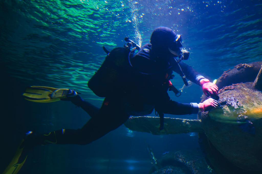
Malik Churnside hovered over a seabed that no human has walked since the sea swallowed it, scanning sediment for traces of the people who lived there before the water arrived. On that survey dive off the Pilbara coast of Western Australia, the Murujuga ranger spotted one of the Seabed Stone Tools that are rewriting Australia's deep human story — a stone artifact lying in the sand.
The discoveries, published in the journal Quaternary Science Reviews in October 2026, show that earlier finds were not isolated but part of a broader submerged cultural landscape across the World Heritage-listed region. The research was led by Professor Jonathan Benjamin of Flinders University with colleagues from the University of Western Australia, James Cook University and the University of York, working with Murujuga Aboriginal Corporation and its rangers. Five of the corporation's rangers trained as scientific divers for the project, and Churnside and fellow ranger Richard Variakojis surveyed the sites and co-authored the paper, according to reporting by phys.org.
More than two million square kilometres of Australia's continental shelf disappeared beneath the ocean as seas rose after the last ice age, and generations of First Nations people lived on country that is now seabed. Murujuga, on the Dampier Archipelago, is famed for a shoreline holding more than a million ancient rock engravings, and in July 2025 its cultural landscape joined the UNESCO World Heritage List — a listing the corporation's own heritage page says explicitly covers submerged landscapes and Sea Country. The Seabed Stone Tools now emerging from that Sea Country make the case concrete.
A Freshwater Spring and a Rocky Hill
The divers documented two distinct parts of the lost world. One site centres on a freshwater spring — the kind of gathering place people needed when the archipelago was still dry land joined to the mainland — close to a spring found earlier in Flying Foam Passage. The other, known as Maitland River Hummock, sits further offshore around a rocky hill beside an ancient river channel, where boulders cover an outcrop suited to quarrying stone. Both sites lie in water between 11 and 15 metres deep and were flooded at least 9,000 years ago, though the tools themselves could be considerably older. Analysis of the stone points to deliberate choices: some artifacts were made from rock sourced around Rosemary Island, about 23 kilometres from where they were found. Valuable stone was selected and carried across a landscape that has since drowned. The Seabed Stone Tools recovered at both sites survived thousands of years of wave action, which is remarkable: archaeologists long assumed such material could not endure for long underwater.
Rangers Who Dive the Science
What sets the project apart is who did the diving. Churnside and Variakojis were among the rangers from the corporation's Land and Sea Unit who trained as scientific divers, locating and documenting the sites alongside archaeologists. Churnside's find came on one of those survey dives, and both rangers are listed as co-authors on the paper. "The collaboration demonstrates the value of working beside trained Indigenous rangers who actively contributed to this challenging scientific research," Benjamin says. Diving with the rangers was a privilege, adds Flinders PhD candidate Louise Brooke, praising their knowledge, connection to Country and enthusiasm. The Seabed Stone Tools they helped recover show that science done with Traditional Owners, rather than around them, finds more — and means more.
Why It Matters After the Listing
The new paper extends a story that began with the Deep History of Sea Country project, whose 2020 dives produced the first reported underwater finds at Murujuga, followed by more in 2023. Those early results now read as the first chapter of a patterned landscape that can be mapped and interpreted like any terrestrial site — which changes the protection math. After the World Heritage inscription, decisions about Murujuga must cover country beneath the sea as well as above it. "Our cultural landscape extends far beyond the shoreline and into Sea Country," says Vincent Adams, director of the corporation. He notes that his community has cared for Murujuga for at least 50,000 years. Those millennia of care are what the Seabed Stone Tools testify to: a continuous relationship with country that did not end when the water came.
And protection is an active question. Recent peer-reviewed monitoring found historic sulphur emissions are the likely cause of damage to Murujuga's famous rock art, according to Australian Geographic's September 2026 reporting — a reminder that a listed landscape can face pressure from many directions. For readers, the takeaway is simple: Australia's deep human story is older and far bigger than the shoreline suggests, and its newest chapter is being written by rangers diving above it.
"These landscapes did not simply disappear when they were flooded," Benjamin says. "They remain part of Country." With the vast majority of Australia's drowned continental shelf still unsurveyed, the researchers say they are only just beginning to grasp the scale of what survives beneath the waves. For now, the Seabed Stone Tools of Murujuga are a reminder that the map of human history still has blank spaces — and some of the most important ones are being filled in by the descendants of the people who made the tools.
Comments 0
No comments yet. Be the first to share your thoughts!
Leave a comment
Share your thoughts. Your email will not be published.