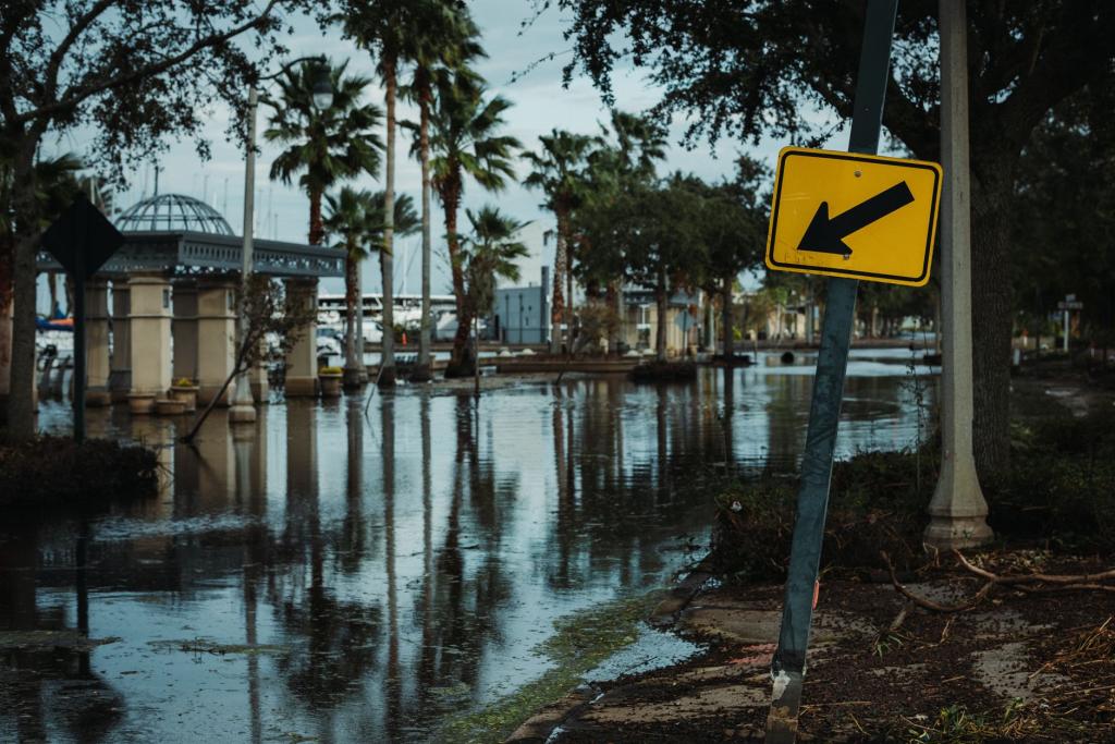
A slow-moving storm system is taking aim at the East Coast this weekend, and forecasters say the worst of it is still ahead. The Coastal Storm now organizing offshore is expected to bring days of onshore wind, heavy rain and major coastal flooding from North Carolina to New Jersey, with the strongest gusts targeting the Outer Banks and southeastern Virginia.
The system arrives on the heels of a volatile Friday. Severe thunderstorms swept the Northeast on October 16, 2026, triggering a multi-state watch across Connecticut, Delaware, Maryland, New Jersey and New York, with damaging winds and isolated tornadoes possible, according to a roundup of the model data. The same broad weather pattern is now expected to feed a coastal low developing just offshore — and unlike a fast-moving front, this one plans to stay awhile.
What to expect, and where
Forecasters describe a storm that parks rather than passes. Wind gusts of forty to sixty miles per hour are expected from southern New Jersey down to Cape Lookout, North Carolina, with the most intense winds — up to seventy miles per hour — aimed at southeastern Virginia and the Outer Banks, according to a storm briefing. The National Weather Service anticipates major coastal flooding along vulnerable shoreline, with southern New Jersey, Delaware and the Virginia Tidewater facing the highest inundation risk as persistent onshore winds pile water into bays, rivers and low-lying roadways through successive high tide cycles.
In the Outer Banks, the threat is existential as well as inconvenient. Several beachfront homes have already collapsed into the Atlantic after earlier seasonal storms, and days of battering waves on saturated ground are expected to accelerate shoreline retreat. It may not be as strong as September's nor'easter, but a system that stalls in place can do outsized damage simply by refusing to leave — erosion is a function of time as much as force.
Rain adds to the problem. As much as six inches could fall in parts of coastal North Carolina, raising the threat of localized flash flooding, and high surf with dangerous rip currents is expected to persist much of the week from Florida's Atlantic beaches to New England, according to weather.com. Beachgoers should obey red-flag warnings and stay out of the surf when the waves look rough. If in doubt, stay out.
The tropical wild card
Then there is the plot twist. The offshore low will linger over the Gulf Stream — a ribbon of unusually warm water off the Carolinas — and if it sits there long enough, it could sprout enough thunderstorms to become a subtropical or even tropical system, according to weather.com. Forecasters put the chance at very low but not zero. The next name on the Atlantic list is Josephine.
The official outlook is calmer. The National Hurricane Center does not expect tropical cyclone formation anywhere in the Atlantic basin during the next seven days, and global models show the system starting as a cold-core low with strong wind shear limiting any rapid strengthening, according to the Climate Cosmos analysis. A brief window of weaker shear could let subtropical characteristics emerge — a maybe stacked on a maybe, which is why the tropical talk stays firmly in the watch column rather than the warning column.
It is not just the East Coast
The Pacific is busier. Tropical Storm Simon is weakening off the Mexican coast near Cabo San Lucas and Baja California, while Hurricane Trudy is forecast to reach major hurricane strength as it tracks slowly near Manzanillo and Mexico's west-central coast early next week, according to FOX Weather hurricane specialist Bryan Norcross. Yet another system may eventually form offshore of southern Mexico, with formation chances rated medium over the next seven days. Three basins, one weekend — and a reminder that October is still very much storm season on both sides of the continent.
What this means for you
If you live anywhere between the Outer Banks and the Jersey Shore, the playbook is straightforward: expect travel disruptions and flooded roads around high tide, secure anything the wind can move, and keep checking the forecast into next week, since this system stalls instead of clearing out. Inland readers mostly get a windy, rainy stretch. And for everyone watching the tropics: the season's next named storm is one warm eddy away from existing — or not. That uncertainty is the forecast. Extreme weather keeps rewriting the calendar this year, from wildfire haze choking Southeast Asia's skies to October surf pounding the mid-Atlantic, and the only reliable preparation is paying attention.
Comments 0
No comments yet. Be the first to share your thoughts!
Leave a comment
Share your thoughts. Your email will not be published.