The odds of a record-breaking El Niño keep climbing
Governor Gavin Newsom declared a state of emergency in California on Monday, September 21, mobilizing state resources ahead of what forecasters say could be a historic winter storm season driven by what could become a record El Niño in California.
The proclamation directs state agencies to prepare for potential winter storms and other impacts tied to the strengthening El Niño. Newsom also proclaimed emergencies to support recovery from three separate severe weather events that caused significant damage in Glenn, Humboldt, Kern, Mendocino, and Santa Barbara counties.
The move follows a September 10 report from the National Oceanic and Atmospheric Administration's Climate Prediction Center that raised the odds of a record El Niño, one exceeding the strength of every El Niño since 1950, to 75 percent. The center put the chance of a very strong event this fall and winter at 90 percent, up from an earlier estimate of 69 percent for a record-breaker.
"California is already taking steps now to protect communities from a potentially historic El Niño because we know how serious these weather extremes driven by climate change can be," California Natural Resources Secretary Wade Crowfoot said in response to the proclamation.
The Pacific is running hotter than it ever has
What started as a wind shift in the western Pacific nine months ago has become an El Niño of record proportions. In the sparsely populated Niño 3.4 region of the central equatorial Pacific, the average ocean temperature on Saturday, September 19, reached 3.05°C above average, the highest peak sea surface temperature anomaly on record, according to the Washington Post's reporting on the latest measurements.
That reading has now surpassed the peaks of the historically significant El Niños of 1997 and 1982. It also arrived roughly two months earlier in the year than the previous peaks, in November 2015 and during an El Niño in 1877 that contributed to a famine that killed an estimated 3 to 4 percent of the world's population.
One measure still stands: the 2015-16 Super El Niño remains the strongest recorded since 1950 by the Oceanic Niño Index, reaching +2.64°C in November 2015, according to NOAA. The index compares a running three-month average of ocean surface temperature to an overall average, so a shorter peak anomaly and the index record can tell slightly different stories about the same event.
Where the warm water sits may matter as much as how warm it is. Climate scientist John O'Brien of the Heising-Simons Foundation told the San Francisco Chronicle that El Niños centered in the far eastern Pacific, with the most unusually warm water near South America, correlate more strongly with California precipitation than central-Pacific events. "The odds of an average winter are very low," he said.
What this winter could look like in California
All of California, particularly Southern California, is expected to receive above-average precipitation between October and December, according to the Climate Prediction Center. NOAA meteorologist Michelle L'Heureux told SFGATE that the strongest probability of increased rain falls between December and March.
The warm Pacific water is already reshaping the coastline. Earlier in the event's development, a subsurface Kelvin wave, a large surge of warm water moving east beneath the ocean surface, raised sea levels across the central and eastern Pacific. Because warm water takes up more space, the wave pushes sea levels higher as it crosses the ocean, and satellites detected the change before all of the subsurface heat reached the surface.
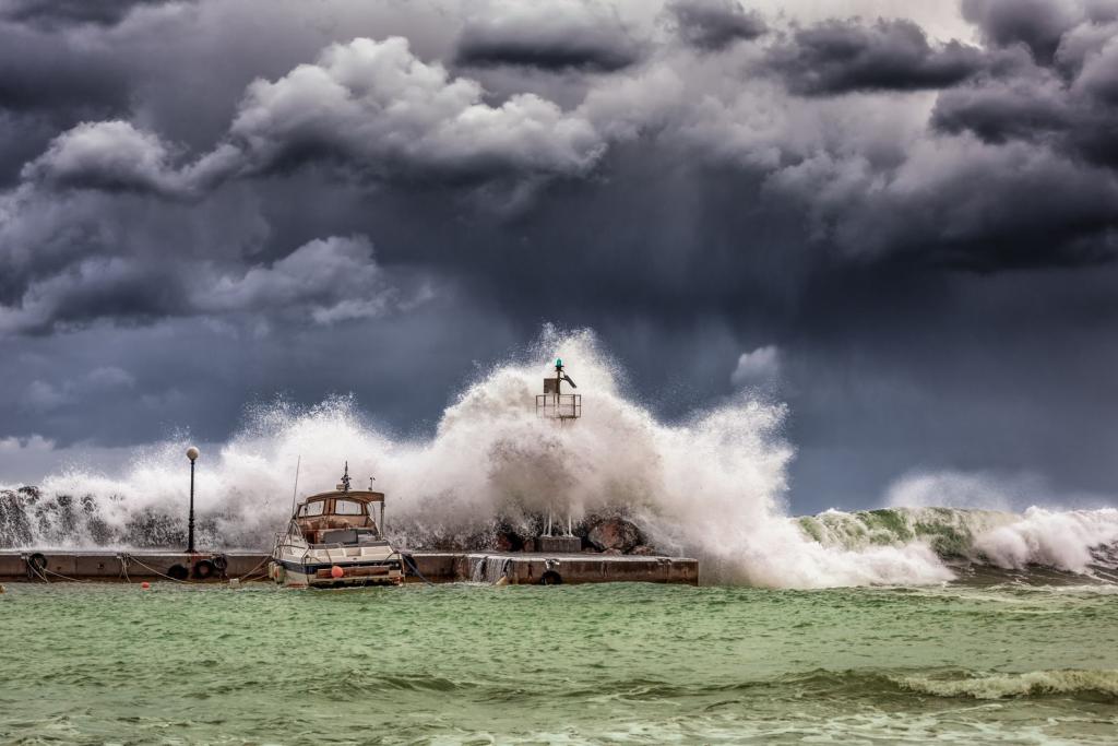
El Niño has already intensified Hurricane Marie, which stayed well offshore but generated large swells that battered Southern California over Labor Day weekend, producing dangerous waves, rip currents, and coastal flooding. A surfer was swept across a rocky jetty by a powerful wave in Newport Beach, and Long Beach, Laguna Beach, and Dana Point all took damage that reshaped beaches and pulled down seawalls in early September.
In Malibu, a massive sinkhole linked to coastal erosion prompted evacuations at a home associated with actor Nicolas Cage, according to a local emergency proclamation issued by the city. The hole, which began developing September 7 as heavy surf pounded the coast and emerged September 8, was estimated at up to 30 feet deep, 30 feet wide, and 60 feet long. Thirty-one homes have been red-tagged for unsafe conditions, gas service to the area has been shut off, and water service may be discontinued if conditions worsen. SF Gate reported that some Malibu beaches have lost about 3.6 feet of coastline per year.
How Californians are being told to prepare
The Governor's Office is urging residents to prepare now for heavy rain, snow, and flooding. Officials recommend signing up for local emergency alerts, checking whether a home or workplace sits in a flood-prone area or below a recent burn scar where mudslides and debris flows are more likely, following city and county instructions during storms, keeping an emergency kit and evacuation plan ready, and never driving through floodwater, which can be deeper and faster than it looks.
El Niño forms every two to seven years when warm water that normally moves west toward Asia instead moves east toward the Americas, driven by weakened trade winds and the slowdown or shutdown of upwelling, the process that brings cold water from the deep ocean to the surface. The warm water shifts the Pacific jet stream south of its neutral position, which tends to bring dry, warm conditions to the northern United States and Canada and increased rain and flooding to the Gulf Coast and Southeast.
Whether this event takes the top spot is still an open question, and the official index record may not be settled until winter. For now, the Pacific is running hotter than it has ever been measured, and California has begun emergency mobilization three months before the heaviest rain of the year.
Comments 0
No comments yet. Be the first to share your thoughts!
Leave a comment
Share your thoughts. Your email will not be published.