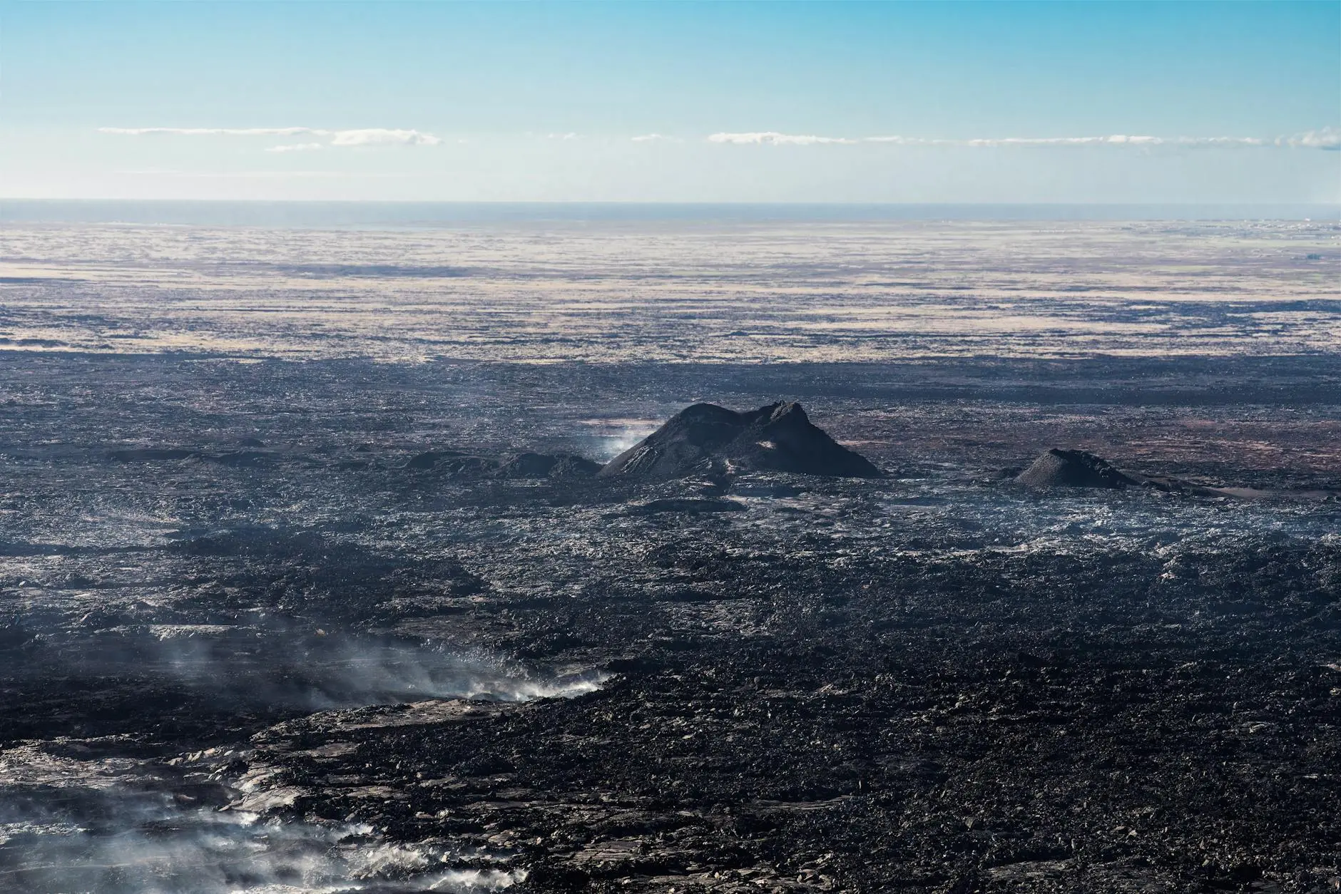
A rare view from space reveals the raw power of one of the world's most active volcanoes. NASA's Landsat 8 satellite has captured stunning imagery of the Mayon volcano eruption in the Philippines, revealing bright red lava flows streaming from the volcano's crater as seen from orbit. The image, taken on February 26, 2026, shows lava, ash, and volcanic gases flowing from Mayon, the most active volcano in the Philippines, which has been erupting since January 2026.
The NASA satellite imagery provides a unique perspective on the ongoing Mayon volcano eruption that has already displaced hundreds of families and kept the Philippines on high alert. According to the Manila Bulletin, the effusive eruption entered its 51st day in late February 2026, with lava flows extending up to 3.8 kilometers down the southern and eastern gullies of the volcano.
The Science Behind the Mayon Volcano Eruption
Mayon Volcano, located in the province of Albay on the island of Luzon, is renowned for its perfect cone shape and frequent volcanic activity. The current Mayon volcano eruption began in January 2026 and has been characterized by continuous lava effusion, summit dome collapses, pyroclastic density currents, and incandescent rockfalls. The Philippine Institute of Volcanology and Seismology (Phivolcs) has maintained Alert Level 3, indicating heightened magmatic unrest with potential for hazardous explosive eruptions.
Satellite data from the ongoing Mayon volcano eruption shows emissions reaching up to 400 meters above the summit, with frequent ash plumes and active lava flows visible from space. According to The Philippine Star, sulfur dioxide emissions have averaged 3,749 tons per day, indicating significant volcanic activity beneath the surface. Seismic monitoring has recorded frequent volcanic earthquakes, rockfalls, and pyroclastic density currents emanating from the summit crater.
The Landsat 8 satellite, operated by NASA and the U.S. Geological Survey, captured the Mayon volcano eruption using its thermal imaging capabilities. These sensors can detect the heat signatures of lava flows and distinguish them from surrounding terrain, providing scientists with valuable data about the extent and intensity of volcanic activity. The bright red color visible in the satellite imagery represents the intense heat of molten rock flowing from the crater at temperatures exceeding 700 degrees Celsius.
Impact on Local Communities
The ongoing Mayon volcano eruption has had significant consequences for communities living near the volcano. According to the Global Disaster Alert and Coordination System, approximately 1.39 million people live within 30 kilometers of Mayon. The current eruption has displaced over 4,000 residents who have been evacuated to temporary shelters across evacuation centers in Albay province.
Authorities have enforced strict safety zones around the volcano, prohibiting entry into the 6-kilometer danger zone and advising residents in extended zones to remain vigilant and prepared for evacuation. The persistent lava flows pose immediate threats to infrastructure and agriculture in the region, while ash emissions affect air quality and visibility across broader areas.
Local officials continue to coordinate emergency response efforts, providing displaced families with food, shelter, and medical assistance. The prolonged nature of the Mayon volcano eruption has created ongoing challenges for disaster management, requiring sustained resources and support for affected communities.
Why Satellite Monitoring of Volcanic Eruptions Matters
For Gen Z interested in earth sciences and climate technology, the Mayon volcano eruption demonstrates the critical role of satellite monitoring in modern disaster management. Space-based observations provide real-time data that ground-based sensors cannot match, enabling scientists to track changes in volcanic activity across vast and often inaccessible terrain.
NASA's Earth observation satellites, including Landsat 8, provide crucial information for volcanologists worldwide. The thermal imaging capabilities allow researchers to measure lava flow temperatures, track movement patterns, and predict potential hazards before they reach populated areas. This data helps emergency managers make informed decisions about evacuations and resource allocation during events like the Mayon volcano eruption.
The Mayon volcano eruption also highlights how space technology contributes to public safety in developing nations. The Philippines relies on international satellite data to supplement local monitoring networks, demonstrating the global cooperation necessary for effective natural disaster management. For young people considering careers in STEM fields, the intersection of space technology and earth sciences offers opportunities to address real-world challenges affecting millions of people.
As climate change potentially increases volcanic activity in certain regions, the importance of satellite monitoring will only grow. The stunning imagery from the Mayon volcano eruption serves as both a scientific tool and a reminder of the powerful geological forces shaping our planet.
Comments 0
No comments yet. Be the first to share your thoughts!
Leave a comment
Share your thoughts. Your email will not be published.